Navigating the Digits: A History of Chicago ZIP Codes
The ZIP code, a term so commonly used today in addresses across the United States, has a history as unique as its pivotal role in modern communication and logistics. Standing for "Zone Improvement Plan," ZIP codes are a system of postal codes implemented by the United States Postal Service (USPS). Let's delve into the origins and evolution of this system that revolutionized mail delivery.
The Pre-ZIP Era
Before ZIP codes, the process of sorting mail was predominantly manual, involving a substantial amount of labor and being prone to human error. As the volume of mail grew exponentially with the population and business expansion, especially after World War II, it became clear that a more efficient system was needed.
Introduction of ZIP Codes
The pivotal change came in 1963 when the USPS introduced the ZIP code system. This move was aimed at streamlining mail sorting and delivery by dividing the entire country into specific postal zones. The primary objective was to expedite mail delivery and reduce the chances of misdirected or delayed mail.
Structure and Significance
A standard ZIP code is a five-digit number. The first three digits represent the sectional center facility (SCF) - the central mail processing facility to which the mail is sent for processing and distribution. The last two digits signify the specific post office or delivery area. In 1983, an extension to the ZIP code system, known as ZIP+4, was introduced. This consisted of the original five digits followed by a hyphen and four more digits, providing an even more precise location, such as a specific building or apartment complex.
Impact on Mail Delivery and Beyond
The introduction of ZIP codes brought about a significant improvement in mail delivery efficiency. Automation became more feasible, and the system greatly assisted postal workers in sorting and delivering mail more quickly and accurately.
Beyond mail delivery, ZIP codes have found a wide range of applications. They are crucial in demographic, marketing, and planning analysis, as they offer insights into geographical areas for businesses and researchers. Emergency services and planners also use ZIP codes to determine the quickest and most efficient routes for services.
Contemporary Challenges and Adaptations
As technology and digital communication have evolved, so too have the challenges and applications of the ZIP code system. The rise of e-commerce and online shopping has further underscored the importance of accurate ZIP codes for efficient package delivery. The USPS continually adapts to these changes, ensuring that the ZIP code system remains relevant and effective in an increasingly digital world.
The history of ZIP codes in Chicago is a fascinating aspect of urban development and postal management. The term "ZIP code" stands for "Zone Improvement Plan" and was introduced in the United States in 1963 to improve the efficiency of mail delivery.
In Chicago, as in other cities, the adoption of ZIP codes marked a significant shift in the way mail was sorted and delivered. Before ZIP codes, mail was sorted manually, which was time-consuming and prone to errors. With the introduction of ZIP codes, the process became automated, speeding up mail delivery and reducing mistakes.
Number of ZIP Codes in the Chicago Area
The Chicago metropolitan area, known for its vast urban sprawl, includes numerous ZIP codes. As of my last update, the number of ZIP codes in the Chicago area is over 60. However, this number can change as new areas are developed or existing areas are subdivided.
Fun Facts About Chicago Zip Codes
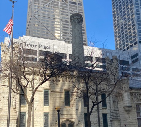
- The Merchandise Mart (River North) was so vast that it possessed its own ZIP Code (60654) until 2008 when the Postal Service reassigned the ZIP Code to a portion of the nearby vicinity. In 2010, the establishment unveiled its Design Center showrooms for public access.
- Burnham is a village located in Cook County, Illinois, United States. As of the 2020 census, it had a population of 4,046. The village is associated with the ZIP code 60633. Burnham shares a 60633 ZIP code with Chicago, which sometimes leads to the misconception that it is a part of Chicago. However, it is, in fact, a separate municipality situated immediately to the south of the Chicago city limits.
Cities Associated with the ZIP Codes
The ZIP codes in the Chicago area cover not just the city itself but also many suburbs and adjoining cities. Each ZIP code can correspond to a distinct neighborhood, suburb, or city. Some of the well-known cities and neighborhoods within these ZIP codes include Evanston (60201, 60202, 60203), Skokie(60076, 60077), Oak Park, and Englewood, among others. Each of these areas has its own unique character and demographic, which is often reflected in the layout and distribution of its ZIP codes.
The First ZIP Code in Chicago
Determining the first ZIP code in Chicago is somewhat complex, as ZIP codes were assigned nationally rather than sequentially within a city. However, it is known that central areas of major cities were among the first to receive ZIP codes. In Chicago, the Loop, being the central business district, likely received one of the first ZIP codes.
Determining the Area for a ZIP Code
The area covered by a ZIP code in Chicago, as in other places, is determined by several factors including population density, geographic boundaries, and the volume of mail. In densely populated urban areas like Chicago, ZIP codes often cover smaller areas due to high mail volume and the need for precise sorting. In contrast, suburban or rural areas might have larger ZIP code areas due to lower population density and mail volume.
The evolution of ZIP codes in Chicago reflects changes in both the city's physical layout and its postal needs. As the city continues to grow and evolve, its ZIP code system adapts, providing an interesting lens through which to view the city's history and development.
Listing all the ZIP codes in the Chicago area along with their associated cities is quite an extensive task, as the Chicago metropolitan area is large and includes numerous ZIP codes. However, I can provide a general overview of some of the major ZIP codes in Chicago and their corresponding neighborhoods or cities:
Downtown Chicago Zip Codes:
- 60601, 60602, 60603, 60604, 60605, 60606, 60607, 60610, 60611, 60613, 60614, 60616, 60654, 60661: These ZIP codes cover areas like the Loop, Near North Side, Lincoln Park, and Near South Side.
North Side Zip Codes:
- 60625, 60640, 60647, 60660, 60645, 60659: Covering neighborhoods like Lincoln Square, Uptown, Edgewater, Wicker Park, Bucktown, Logan Square,, Roscoe Village, and parts of West Ridge and North Park.
West Side Zip Codes:
- 60612, 60622, 60624, 60644, 60651: Including areas like West Town, Humboldt Park, Austin, and Garfield Park.
South Side Zip Codes:
- 60609, 60615, 60617, 60619, 60620, 60621, 60637, 60649: Spanning neighborhoods like Bronzeville, South Shore, Chatham, Englewood, and Hyde Park.
Chicago Suburbs Zip Codes and Nearby Cities:
- Evanston: 60201, 60202, 60203
- Oak Park: 60301, 60302, 60304
- Skokie: 60076, 60077
- Cicero: 60804
- Oak Lawn: 60453
- Orland Park: 60462, 60467
This list is not exhaustive and only includes a sample of ZIP codes in the Chicago area. Each ZIP code can encompass multiple neighborhoods or areas, especially in densely populated parts of the city. For a complete and current list, consulting a detailed map or the U.S. Postal Service's ZIP code lookup tool would be necessary.
From a simple idea to facilitate mail delivery to becoming a fundamental part of the United States' infrastructure, the history of ZIP codes is a testament to innovation in the face of growing challenges. As an integral part of our daily lives, ZIP codes serve not just as a tool for mail delivery, but as a symbol of efficiency and organization in the vast network that connects us all.
- 60004
- 60005
- 60006 Real Estate Search
- 60007
- 60008
- 60009
- 60010 Real Estate Search
- 60011 Real Estate Search
- 60012 Real Estate Search
- 60013 Real Estate Search
- 60014 Real Estate Search
- 60015 Real Estate Search
- 60016 Real Estate Search
- 60017 Real Estate Search
- 60018 Real Estate Search
- 60019 Real Estate Search
- 60020 Real Estate Search
- 60021 Real Estate Search
- 60022 Real Estate Search
- 60026 Real Estate Search
- 60029 Real Estate Search
- 60030 Real Estate Search
- 60031 Real Estate Search
- 60033 Real Estate Search
- 60034 Real Estate Search
- 60035 Real Estate Search
- 60037 Real Estate Search
- 60038 Real Estate Search
- 60039 Real Estate Search
- 60040 Real Estate Search
- 60041 Real Estate Search
- 60042 Real Estate Search
- 60043 Real Estate Search
- 60044 Real Estate Search
- 60045 Real Estate Search
- 60046 Real Estate Search
- 60047 Real Estate Search
- 60048 Real Estate Search
- 60049 Real Estate Search
- 60050 Real Estate Search
- 60051 Real Estate Search
- 60053 Real Estate Search
- 60055 Real Estate Search
- 60056 Real Estate Search
- 60060 Real Estate Search
- 60062 Real Estate Search
- 60064 Real Estate Search
- 60065 Real Estate Search
- 60068 Real Estate Search
- 60069 Real Estate Search
- 60070 Real Estate Search
- 60071 Real Estate Search
- 60072 Real Estate Search
- 60073 Real Estate Search
- 60074 Real Estate Search
- 60076 Real Estate Search
- 60081 Real Estate Search
- 60082 Real Estate Search
- 60083 Real Estate Search
- 60084 Real Estate Search
- 60085 Real Estate Search
- 60086 Real Estate Search
- 60087 Real Estate Search
- 60088 Real Estate Search
- 60089 Real Estate Search
- 60090 Real Estate Search
- 60091 Real Estate Search
- 60092 Real Estate Search
- 60093 Real Estate Search
- 60096 Real Estate Search
- 60097 Real Estate Search
- 60098 Real Estate Search
- 60099 Real Estate Search
- 60104 Real Estate Search
- 60110 Real Estate Search
- 60135 Real Estate Search
- 60136 Real Estate Search
- 60137 Real Estate Search
- 60138 Real Estate Search
- 60139 Real Estate Search
- 60140 Real Estate Search
- 60141 Real Estate Search
- 60142 Real Estate Search
- 60144 Real Estate Search
- 60147 Real Estate Search
- 60148 Real Estate Search
- 60151 Real Estate Search
- 60154 Real Estate Search
- 60155 Real Estate Search
- 60156 Real Estate Search
- 60160 Real Estate Search
- 60161 Real Estate Search
- 60164 Real Estate Search
- 60170 Real Estate Search
- 60171 Real Estate Search
- 60173 Real Estate Search
- 60174 Real Estate Search
- 60178 Real Estate Search
- 60179 Real Estate Search
- 60180 Real Estate Search
- 60181 Real Estate Search
- 60182 Real Estate Search
- 60183 Real Estate Search
- 60184 Real Estate Search
- 60185 Real Estate Search
- 60187 Real Estate Search
- 60188 Real Estate Search
- 60189 Real Estate Search
- 60190 Real Estate Search
- 60192 Real Estate Search
- 60194 Real Estate Search
- 60195 Real Estate Search
- 60305 Real Estate Search
- 60402 Real Estate Search
- 60419 Real Estate Search
- 60430 Real Estate Search
- 60431 Real Estate Search
- 60432 Real Estate Search
- 60433 Real Estate Search
- 60434 Real Estate Search
- 60435 Real Estate Search
- 60436 Real Estate Search
- 60437 Real Estate Search
- 60438 Real Estate Search
- 60439 Real Estate Search
- 60440 Real Estate Search
- 60455 Real Estate Search
- 60513 Real Estate Search
- 60514 Real Estate Search
- 60521 Real Estate Search
- 60523 Real Estate Search
- 60558 Real Estate Search
- 60601 Real Estate Search
- 60602 Real Estate Search
- 60603 Real Estate Search
- 60604 Real Estate Search
- 60605 Real Estate Search
- 60606 Real Estate Search
- 60607 Real Estate Search
- 60608 Real Estate Search
- 60610 Real Estate Search
- 60611 Real Estate Search
- 60612 Real Estate Search
- 60613 Real Estate Search
- 60614 Real Estate Search
- 60615 Real Estate Search
- 60616 Real Estate Search
- 60617 Real Estate Search
- 60618 Real Estate Search
- 60619 Real Estate Search
- 60620 Real Estate Search
- 60621 Real Estate Search
- 60622 Real Estate Search
- 60623 Real Estate Search
- 60624 Real Estate Search
- 60625 Real Estate Search
- 60626 Real Estate Search
- 60628 Real Estate Search
- 60629 Real Estate Search
- 60630 Real Estate Search
- 60631 Real Estate Search
- 60632 Real Estate Search
- 60633 Real Estate Search
- 60634 Real Estate Search
- 60636 Real Estate Search
- 60637 Real Estate Search
- 60639 Real Estate Search
- 60640 Real Estate Search
- 60641 Real Estate Search
- 60642 Real Estate Search
- 60643 Real Estate Search
- 60644 Real Estate Search
- 60645 Real Estate Search
- 60646 Real Estate Search
- 60647 Real Estate Search
- 60649 Real Estate Search
- 60651 Real Estate Search
- 60652 Real Estate Search
- 60653 Real Estate Search
- 60654 Real Estate Search
- 60656 Real Estate Search
- 60657 Real Estate Search
- 60659 Real Estate Search
- 60803 Real Estate Search


Post a Comment